Cemeteries are focused on the past by their very nature. But what will the cemeteries of the future look like? How will we be honoring and remembering the dead in 10, 20, and 50 years? Just as the traditions and rituals around death change, so will the places where we lay the dead to rest.
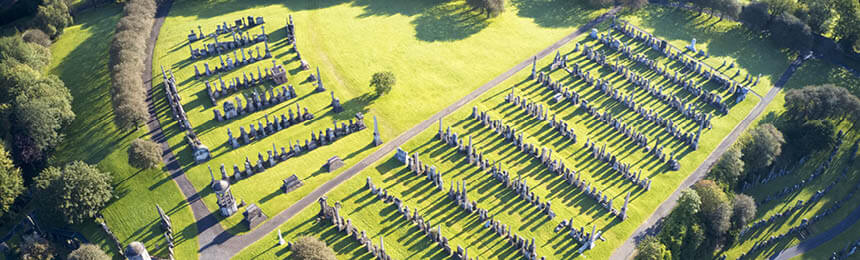
Cemetery mapping software has unlocked a world of opportunity when it comes to recording and planning your cemetery grounds. Not only can you accurately capture all the graves and details of the past in one digital map, but you can also plan and design for future needs – no matter what those needs might be. Here are some of the most important trends and changes occurring within the death care industry, and the various ways that cemetery managers are planning for the future in a practical sense.
The rising rate of cremation
It’s no secret that cremation rates have been rising steadily in many countries. As one example, the US cremation rate has grown from around 5% in the 1970s to 54% by 2019. COVID-19 has boosted the cremation rate even higher. Even before the pandemic, it was predicted that the US cremation rate could be as high as 79.1% by 2035.
What does this mean for cemetery mapping?
It means providing more options for the placement of ashes, which might include tree memorials or memorial gardens, memorial fountains, niche walls, family memorials, and/or mausoleum niches. If you plan to expand your cremation memorial options, now’s the time to be identifying potential locations on your byondpro digital cemetery map to help you add value and choice.
Green burials and sustainable practices
As awareness grows around environmental consumer choices, more people are becoming aware of greener burial options. There’s a growing awareness that caskets, formaldehyde, concrete vaults, and coffin components can take decades to break down. Cremation is not immune to criticism either, with each cremation said to release around 50kg (or over 110 pounds) of CO2 into the atmosphere.
There are a number of new techniques becoming available to provide greener funeral choices in order to meet demand. In 2019 Washington State became the first US state to legalize a corpse composting technique called natural organic reduction, which uses 131°F (55°C) heat and wood chips to encourage microbes to break remains down to stable and usable soil. Alkaline hydrolysis, or water cremation, is growing in availability and popularity in the US and other locations. Natural burial is also growing in demand, which favors GPS coordinates, shrouds, and wild grass over headstones, coffins, and manicured lawns.
What does this mean for cemetery mapping?
Many cemeteries are planning ahead to adapt, plotting out woodland sections using their cemetery layout software to suit the demand for more natural burials. GPS mapping capabilities will only become more important as time goes on so that families can easily and accurately find their loved ones’ plots with a simple online search.
The evolution of cemetery design
Thanks in part to Death Cafés and greater transparency around death care, we’re seeing a distinct shift away from the old-fashioned perception of cemeteries as gloomy and static places. Modern cemeteries are more likely to offer beautifully landscaped gardens, pathways, public spaces, and even playgrounds.
This isn’t actually a new concept. Cemeteries were considered the first public green spaces in some urban locations, where crowds could picnic and socialize. Interaction between communities and cemeteries is once again increasing in some surprising ways. Some communities plan stargazing nights in their cemeteries due to the low light pollution. Some cemeteries hold Open Days or guided tours on their grounds, such as the historical tours offered at Geelong Eastern Cemetery. Other cemeteries are hosting yoga or marathons. It’s time to think once again of cemeteries as living, vibrant spaces in our communities.
What does this mean for cemetery mapping?
These events may not be suitable for all cemeteries. But even if you’re not keen on yoga in the memorial garden, your cemetery layout software can play a key role as you plan to meet community needs. Flower gardens, sculptures, play areas, and trees can all be marked as points of interest on your cemetery map. You can also use your schedule of services to provide service and event information via your website or at a kiosk or venue displays at the cemetery.
Connectivity, interactivity and accessibility
Modern mapping tools have made it easier than ever to build up a rich picture of cemetery grounds – particularly those with fascinating or important histories. Visitors can search deceased records online to find their loved ones and ancestors, using their PC, phone, or an onsite kiosk. This can include historically significant information. For example, Ballarat General Cemetery in Australia compiled extensive community information to identify thousands of WWI veterans’ graves using byondpro.
Accessibility is also on the rise when it comes to cemetery management. It’s now possible to provide digital cemetery maps or 360° tours on your website, allowing families to choose a plot or visit a grave without leaving home. These capabilities can be a wonderful tool for those with limited mobility. Digital maps can also transform accessibility and efficiency within the cemetery office, with the ability to measure plots and plan inventory right there on the screen. Gravediggers and grounds workers can access the information they need on their own devices, too.
What does this mean for cemetery mapping?
To provide optimal connectivity, interactivity, and accessibility, developing your comprehensive digital map with cemetery management software will only become more important. It allows the community and your team to find information quickly and easily. It also allows you to create a full picture of your cemetery’s history. Geelong Cemeteries Trust now provides deceased search right back to 1839, for example.
The issue of space
Cemeteries near urban centers are rapidly reaching capacity across the world, from Sydney to Surrey. Many cemeteries address this through the reusing of graves. In Germany, it’s standard practice to exhume and cremate remains after 15-30 years to free up space. Different states and territories of Australia have various maximum lease terms for graves, and the end of a lease can prompt a ‘lift and deepen’ which places the remains further down in the grave to free up space.
The rising popularity of cremation and natural burials will also assist in space management for those who can offer the facilities, while other cemeteries look to upright burial to optimize space. Some high-density cities employ multi-story columbaria or graveyards. The tallest cemetery in the world? That would be the Memorial Necrópole Ecumênica III in Brazil, at 32 stories high.
What does this mean for cemetery mapping?
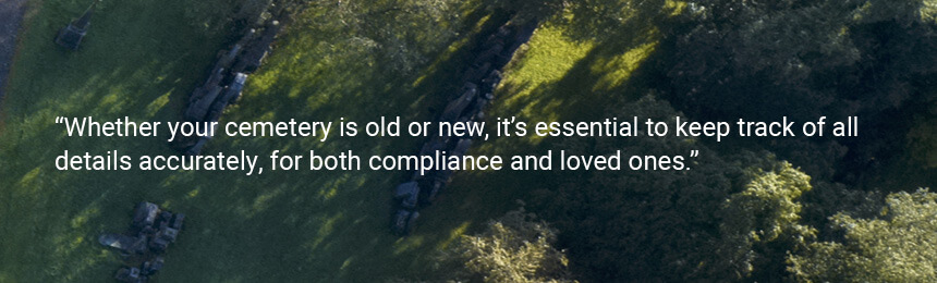
Whether your cemetery is old or new, it’s essential to keep track of all details accurately, for both compliance and loved ones. With detailed mapping software, you can maintain a clear picture of each grave’s history.
In conclusion
It’s impossible to deny that the ways in which we’re farewelling, honoring, and remembering the dead are changing. If cemeteries wish to keep up with expectations, demand, and compliance, then cemetery management software with mapping capabilities is essential. byondpro offers one of the most comprehensive, advanced solutions on the market. You can read more about its mapping features or request a personalized demo with your local OpusXenta team.