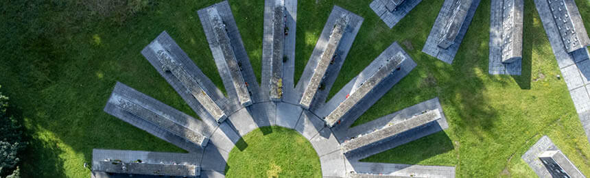
Cemetery mapping is essential; for visitors, it allows easy access to the graves or memorials they are seeking, and for the cemetery or crematory, it provides a clear list of their inventory (used and available) and helps manage operations. However, mapping a graveyard or any site can come with some challenges; the complexity of these can vary based on the age of the site and the accuracy of records. Below we look at 5 cemetery mapping challenges and how to overcome them.
The graveyard maps of today are online and digital. Some cemeteries offer virtual tours of their grounds; others can show you a satellite image of the grounds, some even a photo of the headstone. In addition, many larger cemeteries now offer self-serve kiosks, so on arrival, visitors can search the deceased records and be shown a map with directions to the site. They can also use Google maps integrated into a graveyard map to walk you to the designated location.
How to make a cemetery plot map: prepare in advance and find a suitable partner, be it community members or a cemetery software partner who can assist. There will be challenges. We look at the top five below, but there are also solutions to get your graveyard mapped.
Poor historical record-keeping or missing records
Unmarked graves (and not necessarily paupers graves); many cemeteries often “suspect” an area has been used for burials but have no idea of specifics because they are unmarked. There are many reasons this could have happened, a massive influx of bodies due to disease, unclaimed or paupers’ burials, and historically not all people were buried as equals, be it for cultural, religious, or other reasons. Most cemeteries rely on paper records, and these are particularly prone to damage and disaster, and duplicates are uncommon. So if your cemetery records are damaged or missing, local churches or community groups may be able to assist with deceased records. However, they probably would not have recorded the specific plot or memorial within the graveyard. To identify graves without markers, you can dig or excavate the site, but this is not ideal in most working cemeteries. Alternatively, radar equipment can be used to find disturbed soil and from here mark out graves. If you are lucky enough to have some radar experts in your community, they may be able to assist, as this is far less invasive than excavating.
Inconsistency in locations of graves
When you think of a graveyard, you probably imagine graves or crosses in neat rows with sequential numbers or identification. It would be great if your Graveyard manager was always one to stick to guidelines (assuming they had any), and this continued throughout the life of the cemetery. It’s far more likely, particularly in older graveyards, that there is no consistency in where graves are located. Many cemeteries are segmented into areas for different cultures and religions; each of these areas could be managed entirely differently. In this instance, it is almost impossible to recreate a random plot map with any accuracy. Again this presents a challenge to mapping.
With unmarked graves, at least you know there is a plot that has been occupied, so you are looking for something. Cremation is entirely different; even though a graveyard may have a memorial garden, the placement of ashes in these gardens is most likely to be ad-hoc at best. Many cemeteries now offer a variety of available botanical species so people can specify they would like their ashes under a cherry tree, near a pond, or at the foot of a specific rose. Unlike graves, you can place multiple memorials in a single location. Even if you have excellent record-keeping for cremation memorials at some point, some plants and garden features would have been replaced; due to failing health, potentially dangerous, or they were no longer required – were all memorial records updated to reflect this? Probably not.
The big one – Budget
It all comes down to how accurate your records and site drawings are and the size of your cemetery or cemeteries. It can be a costly exercise, and it is very labor-intensive to prepare all the information you need for graveyard mapping. It is getting cheaper, though; drones are often used today to fly over cemeteries and take photos of all areas. Once this is achieved, the plot locations need to be attached to a GPS coordinate. Then this information creates an overlay for something referenceable like Google Maps. However, each plot and memorial location needs to be tagged and then linked to the deceased records, and much of this work is manual. So the task can be mammoth, but increasing it can be done utilizing technology. Still, in many instances, cemeteries have called on the local community and volunteers to help to minimize the cost.
Inaccurate or abstract site drawings
Similar to your deceased records, site drawings for your cemeteries may not be well maintained. They may use an internal reference number or are based in Excel, and not even a drawing per se. Maps may be damaged or have been lost or destroyed. Throughout the life of a cemetery, the way plots were recorded and indexed may have changed significantly. Alternatively, you may have great drawings, but they bear no representation of the actual space you have within the cemetery and are not geo-referenced.
Conclusion: Graveyard Mapping is Essential
Graveyard mapping will increase interest in and access to your cemetery with a new audience. It will bring a new audience and potential customers to your graveyard. As a business, you will have a thorough list of your inventory and be able to optimize the space remaining on your grounds. There are some differences in how to make a cemetery plot map and cemetery programs that can assist. The community around you also offer skills and resource they are willing to volunteer to help find unmarked graves, transcribe records, search for missing records, any of the things you will need to do in preparation for mapping your cemetery. Graveyard mapping recognizes your history and supports your future, and plays an integral part in your local community story.
Want to know more? Read about our cemetery mapping and plot management software.